
GLOBAL BENCHMARK IN GEOTECHNICAL INSTRUMENTATION
A record of manufacturing excellence for over half a century. Soil Instruments is a world leader in the design, manufacture and supply of premium quality geotechnical and structural monitoring products.
We have over 50 years of experience in the monitoring of dams, reservoirs, deep excavations, landslides, earthworks, structures, tunnels and railways, working on structures and environments on a global scale.
Some of our recent projects include providing instrumentation for Crossrail C701, Europe’s largest civil engineering construction project the Perth Metro; the Son La Dam in Vietnam; the Marina Barrage in Singapore and numerous Network Rail routes across the UK.
Visit our projects page to learn more about our capabilities and how Soil Instruments can offer reliability, safety and stability.
Alongside our UK headquarters, we have offices in France, Germany and Australia, enabling us to manage assignments on a global scale.
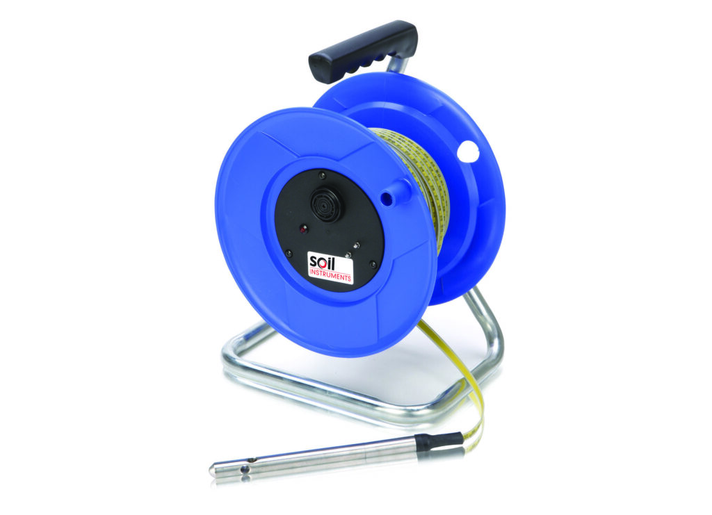
Digital Inclinometers

Inclinometers are used to measure horizontal displacements in the ground or structures. The measurements provide important information about the depth, direction, magnitude and speed of movements, provided that frequent repeat measurements are performed. The measurements are used, among other things, to map deformations on, for example: sheet piling, diaphragm walls, quay walls, dikes, transport pipelines and all kinds of structures.
GEOSmart
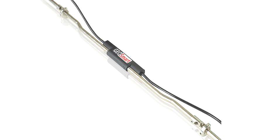
GEOSmart is a modular in-place inclinometer consisting of MEMS sensors that are serially connected and placed 0.5 meters apart on a stainless steel guide with a single cable running along the length of the string. This significantly simplifies installation and reduces the number of cables protruding from the top of the borehole. GEOSmart is installed in a 40 or 70 mm tube and is used for continuous monitoring of horizontal displacements in geotechnical applications such as embankments, retaining walls, and landslides. Thanks to its lightweight, robust construction with connections that can bend up to 90°, GEOSmart is easy to transport to the site and can be installed by just one technician. Reusing sensors is also straightforward. The segments can be connected in any desired length.

Piëzometer
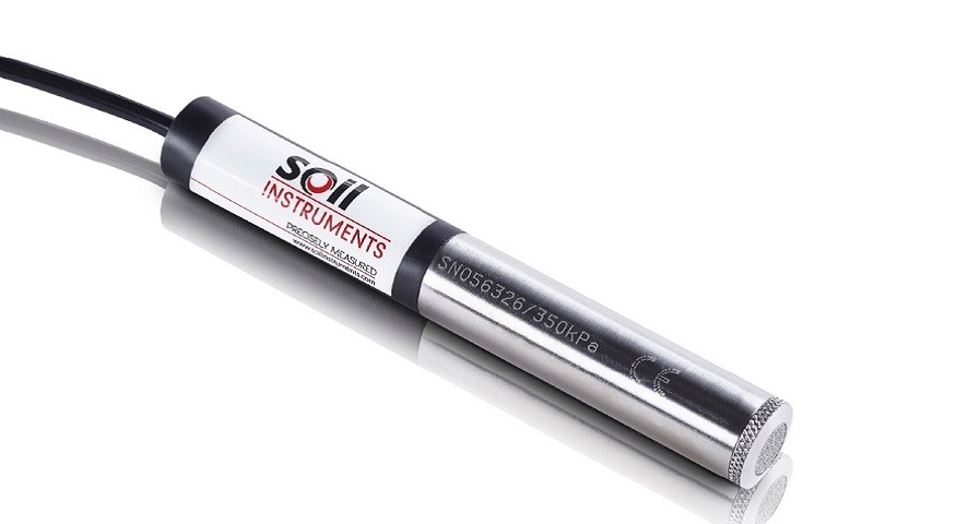
The piezometer can be placed in a borehole, monitoring well, or water well. The cable of the piezometer can be connected to a readout device for manual measurements or to a data logger for continuous monitoring.
Data Processing
The data can be read manually or the system can be connected to a data logger that sends the data to your FTP environment at desired intervals. The output is available in standard engineering units for further processing.
Application
The piezometer is used to gain insight into local water pressure. For example, in case of embankments, it can indicate when the next layer can be added. Other applications include monitoring water levels during dewatering operations or within dike bodies.
Advantages of this VW piezometer from Soil Instruments include:
• Narrow diameter of only 19 mm
• Built-in temperature compensation
• Fast response to changes in water pressure in permeable soils
• Available in various measurement ranges (0-1000 kPa)
Casings
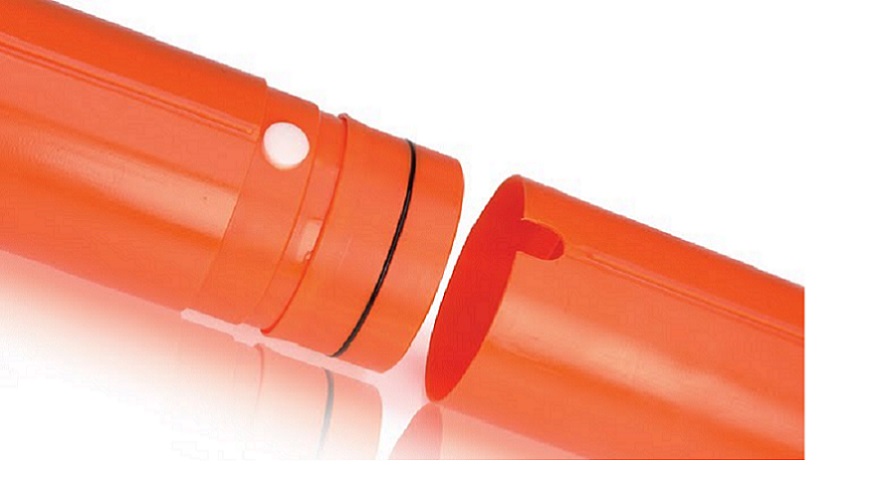
It is recommended to use the inclinometer in the specially available casing tubes.
The use of the inclinometer casing will result in a long lifespan and is easy and quick to install.
The casings are available in sections of 1, 2 or 3 meters so that the desired measuring depth can easily be achieved. To prevent dirt in the measuring tube, the tubes are provided with a top and bottom closure. To prevent vandalism, this top fence is also available with a lockable security cover.
Loadcell
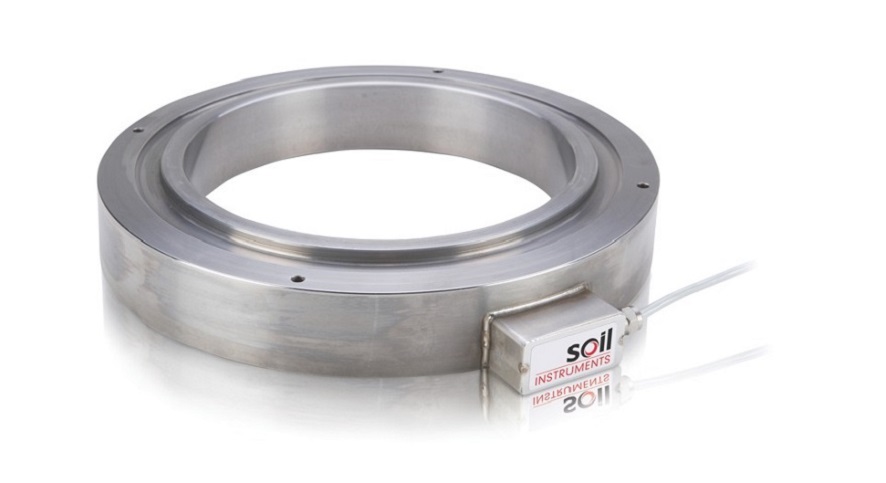
Load cells are used to monitor the load. Typical applications where load cells are used include testing anchors, tunnel connections, or pile loads. Load cells are available in various models ranging from 300 kN to 3000 kN. The load cell is equipped with a cable that can be connected to the Profound IS system. This way, the measurement data is stored in the IS-Field Unit for further processing on your PC.
Waterniveaumeter
With this system, you can easily measure the water level manually in a monitoring well or borehole. There are two types available: one with a narrow probe with a diameter of 12 mm and a standard probe with a diameter of 15 mm. The standard version can also be supplied with a temperature sensor. Both versions are available with cable lengths ranging from 30 to 500 meters.
Operation
The system is easy to use. Lower the probe into the monitoring well or borehole. When the probe comes into contact with water, the system will emit an audible signal. The water depth can then be easily read.
Tiltmeter
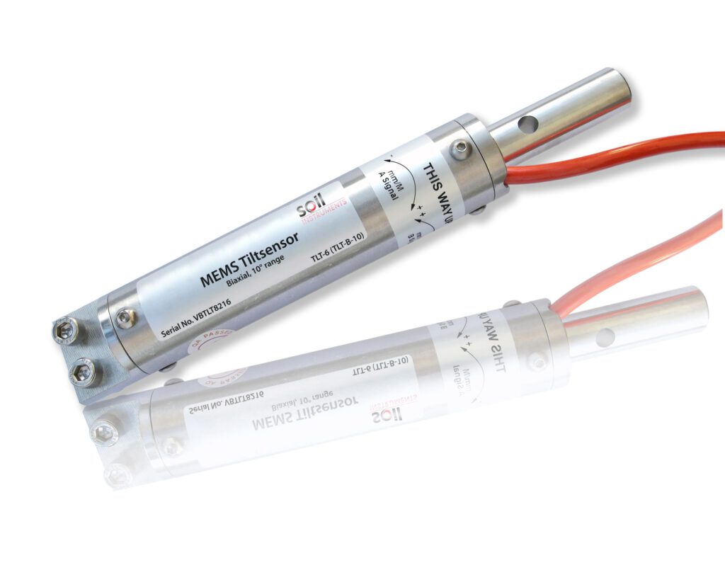
Tiltmeters are used to monitor the inclination of an object in the vertical direction.
The sensor is particularly useful where clear lines of sight are lacking or access to the project location is limited. Each tilt sensor is connected to a data logger for power supply, data storage, and transmission to your PC or server for further processing of the measurement data.
Tilt sensors are available in various types.